Getting the weather forecasting you need from Met Éireann
Good news from Met Éireann ! Their new weather forecasting site now allows you to get 3 hour, 5 day and even 7 day forecasting. We caught up with Joanne Walker, Senior Meteorological Officer at Met Éireann to find out more about their new site and updated forecasting system.
What does the new site offer sailors and how do we find it?
The new weather forecast map for the next seven days can be run on the website homepage (www.met.ie) and mobile app by pressing play at the bottom of the map screen.
Users can choose between map screen displays to run the rainfall radar as well as forecasts for different weather types e.g. air temperature, wind speed/direction and forecasted rainfall in hourly intervals for the first 48 hours, before changing to 6 hour intervals for up to 7 days. Weather forecast data for your local area can similarly be accessed by dragging the scroll bar at the bottom of the meteogram below the maps. You can set your local area by searching it on the box at the top right hand corner of the homepage.
Use the App, not the Website on your phone !
It is important that mobile device users download the Met Éireann app on their smartphones to best view the homepage forecast information rather than opening the full website on their mobiles.
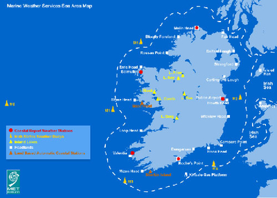
Joanne commented: “The Atlantic charts for wind and airmass are now available on our new website under the Forecast menu. We have received many positive responses from the sailing community to the new features available on our website and app, especially the functionality to zoom and play the Wind forecast map. We hope this and other features will be a useful tool for your members in their sailing activities”
What should I do next ?
Refresh your website url
Set up the new website by using the new url https://www.met.ie/ rather than a bookmark kept from the old site. When you land on the site (or after clearing browser history) a popup asks you to allow the site set your location. Please allow this.
The old site will remain available for a short time only: http://archive.met.ie/
Square Weather Map of Ireland
The square weather map of Ireland at the top of this homepage combines the radar, 3 hour, Short Range and 5 day forecast into the one map in a different format but now extends to 7 days ahead. The first 2 days are hourly forecasts, then it switches to 3 then 6 hourly. All the maps (apart from the Radar) are from computer generated model data (Numerical Weather Prediction) and should be viewed as a guideline only.
Select the map options (on the right hand side):
Rainfall Radar, please read legend and scale under map for more information.
Forecast Overview – our weather forecasters manually produce the weather icons for midday and midnight, reflecting the predicted major weather type for these times- up to 5 days ahead.
Rainfall Forecast (7 day) – this is direct model output from Numerical Weather Prediction models (along with all subsequent maps). You are advised to read the legend and scale under the map for more information.
Wind – Legend information and scale under map. Wind strength in knots/kmh are indicated by map colour. Also, the arrow tip points in the direction the wind is blowing and the tail length indicates wind strength.
Temperature – air temperature, see legend information and scale under the map.
Pressure - see legend information and scale under the map.
Other Maps
Apart from Pressure, all other maps can be zoomed into an area and the forecast/radar played in this zoomed mode. Click Play at the bottom of the map to play the weather forecast for each parameter, similarly to how the previous Short-Range and 5 day forecast graph worked. The first 2 days are hourly forecasts, then it switches to 3 then 6 hourly.
Tailored Location Forecast
To get a tailored forecast for an area you can click a location on the map or type a location into ‘Enter Location’ on the top right. This will give you the midday outlook and a combined graphical seven day forecast showing hourly breakdown weather forecast information for the next 2 days after that. In addition, by scrolling up to the map with a blue dot at the location, you will see rainfall, forecast overview, wind, temperature or pressure. Athlone is used as an example.
Text Weather Forecasts
Under this is the National and Regional text weather forecast. The location will be remembered every time you enter the site, if not it should remain in the Recent Locations on the right of the map, the placenames can be clicked. The homepage is designed to provide a tailored comprehensive weather forecast for a specific location and can be viewed in three ways - maps, detailed forecast and National/Regional text.
The Atlantic Charts are back !
As part of the continued work to serve a facility to the sailing community and others, the Atlantic Charts have returned so you can watch pressure systems and rain / airmass play on your screen with new chart every 6 hours up to 7 days ahead https://www.met.ie/forecasts/atlantic-charts.
Using your mobile to access the Met Éireann app
The best way to use all this info is to download the Met Éireann app from your app store, and allow the app to access your location.
ANDROID HERE ... https://play.google.com/store/apps/details?id=net.fusio.meteireann&hl=en_IE
APPLE HERE ... https://itunes.apple.com/ie/app/met-%C3%A9ireann-weather-ireland/id592109880
For more reading, get the inside facts from Met Éireann’s latest "Recent Warm Weather Report" https://www.met.ie/cms/assets/uploads/2018/07/WarmWx12072018.pdf